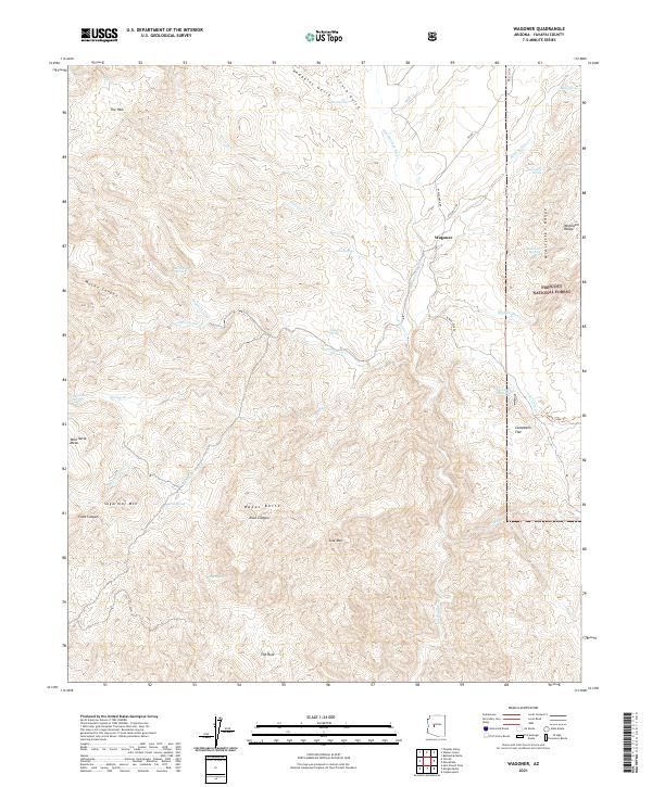
2021 Map of Wagoner
USGS Topo · Published 2021About this map
The Hassayampa River flows through the center of this Yavapai County landscape, anchoring a region of complex high-desert topography. The settlement of Wagoner serves as a local hub near where Milk Cr and several mountain springs converge, while Campbells Flat sits further east toward the Prescott National Forest boundary. The map captures a transition from the elevated McAllister Range in the northeast to the distinctive southwestern formations of Sugarloaf Mtn and Wild Horse Mesa. This area is defined by a network of seasonal water sources and canyons, with landforms such as Wades Butte and Mocho Canyon illustrating the drainage patterns leading toward the river. Local infrastructure is minimal, consisting of forest roads like W Wagoner Rd and footpaths such as the Cherry Creek Trl, highlighting the region's character as a working ranching and wilderness interface.
Find a feature on this map
52 named features on this map. Tap any name to fly to it.
Don’t see what you’re looking for? This feature index may not catch every label — zoom into the map to look around manually.
Map Details
Editions of this 2021 Wagoner Map
This is the sole edition of this map. No revisions or reprints were ever made.
Other maps of this area

1887 · Prescott
USGS Topo · 1:250,000

1892 · Prescott
USGS Topo · 1:250,000

1903 · Bradshaw Mountains
USGS Topo · 1:125,000

1903 · Congress
USGS Topo · 1:125,000

1904 · Congress
USGS Topo · 1:125,000

1947 · Crown King
USGS Topo · 1:62,500

1947 · Mt. Union
USGS Topo · 1:62,500

1947 · Kirkland
USGS Topo · 1:62,500

1947 · Wagoner
USGS Topo · 1:62,500

1948 · Crown King
USGS Topo · 1:63,360