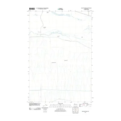
2011 Map of Wahatis Peak
USGS Topo · Published 2011About this map
Wahatis Peak rises as the dominant landmark in this central Washington landscape, standing within the Saddle Mountains at the start of the twenty-first century. The map reveals a drainage pattern defined by the meandering course of Lower Crab Creek, which flows westward through a valley marked by Red Rock Coulee and the basin of Red Rock Lake. Human activity in this arid corridor is characterized by isolated agricultural outposts like the Chadbourne Ranch and Rasor Ranch, which are connected by a grid of rural routes such as Lower Crab Creek Rd SW. The presence of the Natural Corral near the northern boundary suggests the historical utilization of the coulee's unique geology for livestock management in an era when these remote reaches of Grant County remained primarily dedicated to ranching and open-range land use.
Find a feature on this map
15 named features on this map. Tap any name to fly to it.
Don’t see what you’re looking for? This feature index may not catch every label — zoom into the map to look around manually.
Map Details
Editions of this 2011 Wahatis Peak Map
This is the sole edition of this map. No revisions or reprints were ever made.
Other maps of this area

1911 · Red Rock
USGS Topo · 1:62,500

1916 · Coyote Rapids
USGS Topo · 1:62,500

1923 · Corfu
USGS Topo · 1:62,500

1924 · Hanford
USGS Topo · 1:62,500

1950 · Smyrna
USGS Topo · 1:62,500

1951 · Smyrna
USGS Topo · 1:62,500

1951 · Corfu
USGS Topo · 1:62,500

1951 · Hanford
USGS Topo · 1:62,500

1951 · Coyote Rapids
USGS Topo · 1:62,500

1953 · Walla Walla
USGS Topo · 1:250,000