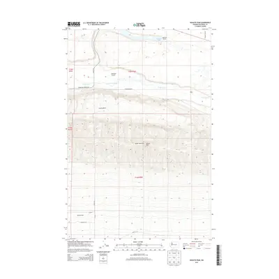
2013 Map of Wahatis Peak
USGS Topo · Published 2013About this map
Wahatis Peak dominates the center of this high-desert landscape within the Saddle Mountains, overlooking a region defined by dramatic geological formations and remote livestock operations. To the north, the waters of Lower Crab Creek flow through a valley marked by the Chadbourne Ranch and Rasor Ranch, indicating the persistent agricultural presence in this arid portion of Grant County. The map details the transition from the high elevation of the peaks down to the Smyrna Bench and the broad Wahluke Slope to the south.
Find a feature on this map
22 named features on this map. Tap any name to fly to it.
Don’t see what you’re looking for? This feature index may not catch every label — zoom into the map to look around manually.
Map Details
Editions of this 2013 Wahatis Peak Map
This is the sole edition of this map. No revisions or reprints were ever made.
Other maps of this area

1911 · Red Rock
USGS Topo · 1:62,500

1916 · Coyote Rapids
USGS Topo · 1:62,500

1923 · Corfu
USGS Topo · 1:62,500

1924 · Hanford
USGS Topo · 1:62,500

1950 · Smyrna
USGS Topo · 1:62,500

1951 · Smyrna
USGS Topo · 1:62,500

1951 · Corfu
USGS Topo · 1:62,500

1951 · Hanford
USGS Topo · 1:62,500

1951 · Coyote Rapids
USGS Topo · 1:62,500

1953 · Walla Walla
USGS Topo · 1:250,000