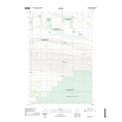
2020 Map of Wahatis Peak
USGS Topo · Published 2020About this map
Wahatis Peak serves as the prominent high point within the Saddle Mountains, overlooking a landscape defined by significant conservation and irrigation infrastructure. The northern portion of the quadrangle is dominated by the Columbia National Wildlife Refuge, featuring the waters of Red Rock Lake and the drainage of Lower Crab Cr. These features, along with Red Rock Coulee and the Natural Corral, reflect the distinct geological legacy of the Channeled Scablands. To the south, the terrain transitions into the Wahluke Slope, where the Wahluke Branch Canal and Canel Rd mark the transition toward the agricultural developments of the Columbia Basin. Large-scale preservation is evident across the region, with the Saddle Mountain National Wildlife Refuge and the Hanford Reach National Monument protecting the arid sagebrush steppe and high-desert environment.
Find a feature on this map
22 named features on this map. Tap any name to fly to it.
Don’t see what you’re looking for? This feature index may not catch every label — zoom into the map to look around manually.
Map Details
Editions of this 2020 Wahatis Peak Map
This is the sole edition of this map. No revisions or reprints were ever made.
Other maps of this area

1911 · Red Rock
USGS Topo · 1:62,500

1916 · Coyote Rapids
USGS Topo · 1:62,500

1923 · Corfu
USGS Topo · 1:62,500

1924 · Hanford
USGS Topo · 1:62,500

1950 · Smyrna
USGS Topo · 1:62,500

1951 · Smyrna
USGS Topo · 1:62,500

1951 · Corfu
USGS Topo · 1:62,500

1951 · Hanford
USGS Topo · 1:62,500

1951 · Coyote Rapids
USGS Topo · 1:62,500

1953 · Walla Walla
USGS Topo · 1:250,000