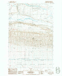
1986 Map of Wahatis Peak
USGS Topo · Published 1986About this map
Wahatis Peak rises as the prominent high point of the Saddle Mountains, overlooking a landscape defined by significant federal land management and irrigation infrastructure during the mid-1980s. To the north, the Columbia National Wildlife Refuge encompasses a complex system of coulees and water bodies including Corral Lake and Red Rock Lake, while the southern portion of the map is dominated by the northern reaches of the Hanford Site (DOE).
Find a feature on this map
24 named features on this map. Tap any name to fly to it.
Don’t see what you’re looking for? This feature index may not catch every label — zoom into the map to look around manually.
Map Details
Editions of this 1986 Wahatis Peak Map
This is the sole edition of this map. No revisions or reprints were ever made.
Other maps of this area

1911 · Red Rock
USGS Topo · 1:62,500

1916 · Coyote Rapids
USGS Topo · 1:62,500

1923 · Corfu
USGS Topo · 1:62,500

1924 · Hanford
USGS Topo · 1:62,500

1950 · Smyrna
USGS Topo · 1:62,500

1951 · Smyrna
USGS Topo · 1:62,500

1951 · Corfu
USGS Topo · 1:62,500

1951 · Hanford
USGS Topo · 1:62,500

1951 · Coyote Rapids
USGS Topo · 1:62,500

1953 · Walla Walla
USGS Topo · 1:250,000