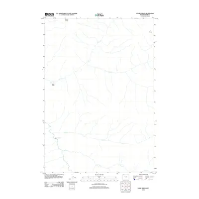
2012 Map of Wahb Springs
USGS Topo · Published 2012About this map
Calfee Creek Patrol Cabin stands as a rare outpost of human presence in this mountain landscape near the confluence of the Lamar River and Calfee Cr. This 2012 survey illustrates a topography defined by significant water systems, where Cache Cr and S Cache Cr drain from the high elevations of Mount Norris and the peak known as The Needle. The drainage patterns suggest a complex watershed feeding into the river system below, while ominous names like Death Gulch hint at the difficult passage and natural hazards inherent to the terrain. The presence of Wahb Springs further indicates the geothermal or hydrological activity characteristic of this part of Park County, Wyoming. This map serves as an essential record of the backcountry trails and remote hydrology that define the wilderness area during the early 21st century.
Find a feature on this map
10 named features on this map. Tap any name to fly to it.
Don’t see what you’re looking for? This feature index may not catch every label — zoom into the map to look around manually.
Map Details
Editions of this 2012 Wahb Springs Map
This is the sole edition of this map. No revisions or reprints were ever made.
Other maps of this area

1886 · Canyon
USGS Topo · 1:125,000

1895 · Canyon
USGS Topo · 1:125,000

1896 · Canyon
USGS Topo · 1:125,000

1896 · Crandall Creek
USGS Topo · 1:125,000

1899 · Crandall
USGS Topo · 1:125,000

1901 · Canyon
USGS Topo · 1:125,000

1907 · Canyon
USGS Topo · 1:125,000

1911 · Canyon
USGS Topo · 1:125,000

1955 · Ashton
USGS Topo · 1:250,000

1955 · Cody
USGS Topo · 1:250,000