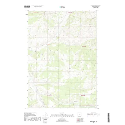
2017 Map of Wahb Springs
USGS Topo · Published 2017About this map
Yellowstone National Park terrain defines this portion of Park County, where the high ridges of the Absaroka Range meet a network of deep-cut drainage basins. The landscape is marked by the rugged verticality of Mt Norris and the distinctive geological features of The Needle and Eye of the Needle. The hydrological pattern is anchored by the Lamar River, which receives various tributaries including Miller Cr, Calfee Cr, and Cache Cr. The presence of Death Gulch and Wahb Springs suggests the active geothermal and volcanic history common to this region of the park. Human passage through this wilderness is primarily recorded by established backcountry routes such as the Lamar River Trail, Cache Creek Trail, and Miller Creek Trail, which follow the natural contours of the river valleys and provide access to the remote northeast corner of the park.
Find a feature on this map
22 named features on this map. Tap any name to fly to it.
Don’t see what you’re looking for? This feature index may not catch every label — zoom into the map to look around manually.
Map Details
Editions of this 2017 Wahb Springs Map
This is the sole edition of this map. No revisions or reprints were ever made.
Other maps of this area

1886 · Canyon
USGS Topo · 1:125,000

1895 · Canyon
USGS Topo · 1:125,000

1896 · Canyon
USGS Topo · 1:125,000

1896 · Crandall Creek
USGS Topo · 1:125,000

1899 · Crandall
USGS Topo · 1:125,000

1901 · Canyon
USGS Topo · 1:125,000

1907 · Canyon
USGS Topo · 1:125,000

1911 · Canyon
USGS Topo · 1:125,000

1955 · Ashton
USGS Topo · 1:250,000

1955 · Cody
USGS Topo · 1:250,000