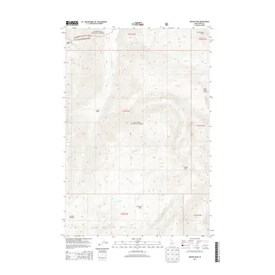
2013 Map of Wahoo Peak
USGS Topo · Published 2013About this map
Wahoo Peak serves as a central landmark in this high-altitude landscape of the early 21st century. Situated along the boundary of the Clearwater National Forest and Nez Perce National Forest, the terrain is defined by a dense network of drainages and prominent divides. To the north, the Goat Heaven Peaks rise above the headwaters of Battle Cr, while Maple Lake Ridge marks the northwestern corner. The map reveals a land shaped by water, with Pettibone Cr and Monument Cr carving deep paths through the wilderness. High-mountain basins hold several small bodies of water, including Indian Lake, Park Lake, and Sid Lake, which provide a contrast to the long, steep ridgelines like Pettibone Ridge and Battle Creek Ridge. This area remains largely undeveloped, preserving a wilderness character focused on the natural topography of Idaho County.
Find a feature on this map
27 named features on this map. Tap any name to fly to it.
Don’t see what you’re looking for? This feature index may not catch every label — zoom into the map to look around manually.
Map Details
Editions of this 2013 Wahoo Peak Map
This is the sole edition of this map. No revisions or reprints were ever made.
Other maps of this area

1911 · Lolo
USGS Topo · 1:250,000

1913 · Lolo
USGS Topo · 1:250,000

1956 · Hamilton
USGS Topo · 1:250,000

1959 · Hamilton
USGS Topo · 1:250,000

1960 · Hamilton
USGS Topo · 1:250,000

1964 · Hamilton
USGS Topo · 1:250,000

1966 · Twin Butte
USGS Topo · 1:24,000

1966 · Dog Creek
USGS Topo · 1:24,000
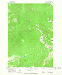
1966 · Wahoo Peak
USGS Topo · 1:24,000
1966 · Freeman Peak
USGS Topo · 1:24,000