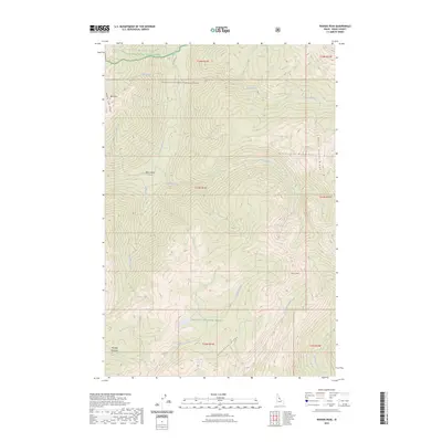
2023 Map of Wahoo Peak
USGS Topo · Published 2023About this map
The Bitterroot Mountains define this high-elevation landscape within the Selway-Bitterroot Wilderness, where steep ridges and deep drainages converge. In this remote section of the Clearwater National Forest and Nez Perce National Forest, prominent landmarks such as Wahoo Peak and Pettibone Ridge provide orientation for those navigating the backcountry. Waterways like the East Fork Moose Creek and Monument Creek flow through narrow valleys, reflecting the drainage patterns of the region.
Find a feature on this map
27 named features on this map. Tap any name to fly to it.
Don’t see what you’re looking for? This feature index may not catch every label — zoom into the map to look around manually.
Map Details
Editions of this 2023 Wahoo Peak Map
This is the sole edition of this map. No revisions or reprints were ever made.
Other maps of this area

1911 · Lolo
USGS Topo · 1:250,000

1913 · Lolo
USGS Topo · 1:250,000

1956 · Hamilton
USGS Topo · 1:250,000

1959 · Hamilton
USGS Topo · 1:250,000

1960 · Hamilton
USGS Topo · 1:250,000

1964 · Hamilton
USGS Topo · 1:250,000

1966 · Twin Butte
USGS Topo · 1:24,000

1966 · Dog Creek
USGS Topo · 1:24,000
1966 · Wahoo Peak
USGS Topo · 1:24,000
1966 · Freeman Peak
USGS Topo · 1:24,000