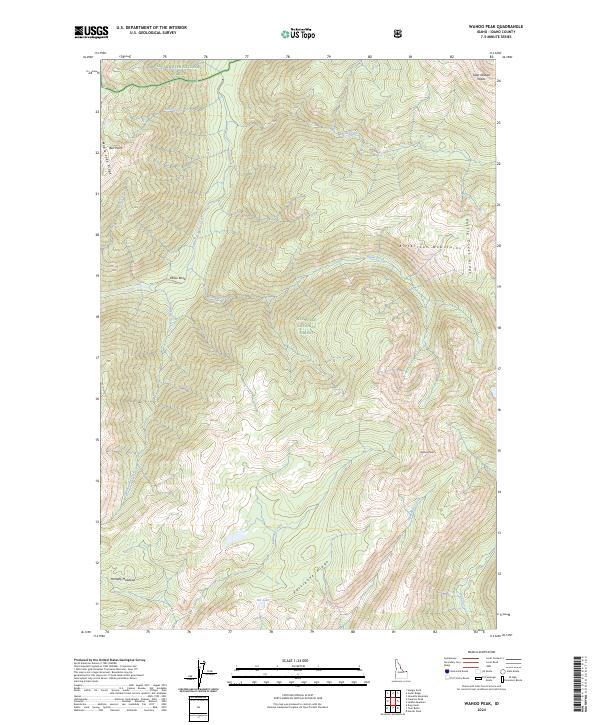
2024 Map of Wahoo Peak
USGS Topo · Published 2024About this map
The Bitterroot Mountains define this high-altitude landscape within the Selway-Bitterroot Wilderness, where the drainage divide separates the waters of Clearwater National Forest to the north from the Nez Perce National Forest to the south. This 2024 survey captures the remote intersection of three national forest jurisdictions, centered on the prominent summit of Wahoo Peak.
Find a feature on this map
28 named features on this map. Tap any name to fly to it.
Don’t see what you’re looking for? This feature index may not catch every label — zoom into the map to look around manually.
Map Details
Editions of this 2024 Wahoo Peak Map
This is the sole edition of this map. No revisions or reprints were ever made.
Other maps of this area

1911 · Lolo
USGS Topo · 1:250,000

1913 · Lolo
USGS Topo · 1:250,000

1956 · Hamilton
USGS Topo · 1:250,000

1959 · Hamilton
USGS Topo · 1:250,000

1960 · Hamilton
USGS Topo · 1:250,000

1964 · Hamilton
USGS Topo · 1:250,000

1966 · Twin Butte
USGS Topo · 1:24,000

1966 · Dog Creek
USGS Topo · 1:24,000
1966 · Wahoo Peak
USGS Topo · 1:24,000
1966 · Freeman Peak
USGS Topo · 1:24,000