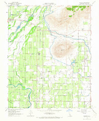
1966 Map of Wahtoke
USGS Topo · Published 1967About this map
Agricultural irrigation networks define this Fresno County landscape in the mid-1960s, where the Kings River feeds an intricate system of canals and sloughs. The Friant Kern Canal and Alta Canal dominate the terrain, illustrating the intensive water management required for the region's orchards and fields. Small rural hubs like Navelencia and Wahtoke serve as focal points for the surrounding farming community, supported by local institutions such as the Navelencia Sch and Great Western Sch.
Find a feature on this map
39 named features on this map. Tap any name to fly to it.
Don’t see what you’re looking for? This feature index may not catch every label — zoom into the map to look around manually.
Map Details
Editions of this 1966 Wahtoke Map
2 editions found
Other maps of this area

1920 · Orangedale School
USGS Topo · 1:24,000

1921 · Squaw Valley
USGS Topo · 1:31,680

1922 · Round Mountain
USGS Topo · 1:31,680

1922 · Trimmer
USGS Topo · 1:96,000

1923 · Sultana
USGS Topo · 1:31,680

1923 · Orangedale School
USGS Topo · 1:31,680

1923 · Wahtoke
USGS Topo · 1:31,680

1923 · Sanger
USGS Topo · 1:31,680

1924 · Reedley
USGS Topo · 1:31,680

1924 · Selma
USGS Topo · 1:31,680