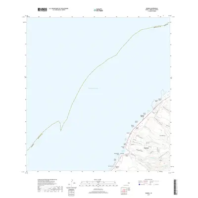
2017 Map of Waimea
USGS Topo · Published 2017About this map
The North Shore of O'ahu is defined by its legendary surf breaks and deep coastal valleys. Along this stretch of Honolulu County, the community of Pupukea sits elevated above the Pacific, overlooking a series of iconic beaches including Banzai Beach and Sunset Beach. The topography is shaped by numerous gulches that drain the interior highlands, most notably Kaunala Gulch and Paumalu Gulch, which cut deep paths toward the shoreline.
Find a feature on this map
48 named features on this map. Tap any name to fly to it.
Don’t see what you’re looking for? This feature index may not catch every label — zoom into the map to look around manually.
Map Details
Editions of this 2017 Waimea Map
This is the sole edition of this map. No revisions or reprints were ever made.
Other maps of this area

1952 · Waimea
USGS Topo · 1:24,000

1953 · Haleiwa
USGS Topo · 1:24,000

1953 · Hauula
USGS Topo · 1:24,000

1954 · Oahu
USGS Topo · 1:250,000

1954 · Kahuku
USGS Topo · 1:24,000

1954 · Kaena
USGS Topo · 1:24,000

1960 · Haleiwa
USGS Topo · 1:24,000

1961 · Oahu
USGS Topo · 1:250,000
1964 · Kaena
USGS Topo · 1:24,000

1965 · Oahu
USGS Topo · 1:250,000