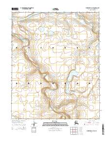
2014 Map of Wainwright A-1 SW
USGS Topo · Published 2014About this map
The Avalik River meanders across the northern portion of this landscape, carving a wide path through the Arctic coastal plain of the North Slope. This 2014 survey documents a remote wilderness environment where water dominates the geography, evidenced by the intricate drainage patterns feeding into the Ketik River further south. The land is defined by these primary waterways, which serve as the central landmarks in an area devoid of permanent human settlements or infrastructure at this scale. For researchers or travelers, the map provides precise topographic detail of the low-lying tundra and the shifting banks of these two significant river systems, illustrating the natural hydrological processes within the National Petroleum Reserve in Alaska.
Find a feature on this map
6 named features on this map. Tap any name to fly to it.
Don’t see what you’re looking for? This feature index may not catch every label — zoom into the map to look around manually.
Map Details
Editions of this 2014 Wainwright A-1 SW Map
This is the sole edition of this map. No revisions or reprints were ever made.
Other maps of this area

1951 · Utukok River
USGS Topo · 1:250,000

1951 · Wainwright
USGS Topo · 1:250,000

1955 · Wainwright
USGS Topo · 1:250,000

1955 · Wainwright A-2
USGS Topo · 1:63,360
1955 · Wainwright A-1
USGS Topo · 1:63,360

1956 · Utukok River
USGS Topo · 1:250,000

1964 · Wainwright
USGS Topo · 1:250,000

1965 · Utukok River
USGS Topo · 1:250,000
1984 · Utukok River D-2
USGS Topo · 1:63,360
1984 · Utukok River D-1
USGS Topo · 1:63,360