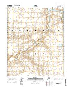
2014 Map of Wainwright A-2 SE
USGS Topo · Published 2014About this map
Avalik River and Ketik River drain this Arctic landscape within the Alaska-North Slope Borough. This 2014 survey focuses on a remote section of the North Slope, where the drainage patterns of Adrigon Cr and the Kaolak River define the local topography. The map illustrates a strictly natural environment, free of permanent settlements or infrastructure, emphasizing the sheer scale of the Alaskan wilderness. Surveyed by the U.S. Geological Survey using SPOT imagery from 2009, it serves as a precise record of the winding river systems and seasonal creeks that have shaped this terrain for centuries.
Find a feature on this map
9 named features on this map. Tap any name to fly to it.
Don’t see what you’re looking for? This feature index may not catch every label — zoom into the map to look around manually.
Map Details
Editions of this 2014 Wainwright A-2 SE Map
This is the sole edition of this map. No revisions or reprints were ever made.
Other maps of this area

1951 · Utukok River
USGS Topo · 1:250,000

1951 · Wainwright
USGS Topo · 1:250,000

1955 · Wainwright
USGS Topo · 1:250,000

1955 · Wainwright A-2
USGS Topo · 1:63,360
1955 · Wainwright A-1
USGS Topo · 1:63,360

1956 · Utukok River
USGS Topo · 1:250,000

1964 · Wainwright
USGS Topo · 1:250,000

1965 · Utukok River
USGS Topo · 1:250,000
1984 · Utukok River D-2
USGS Topo · 1:63,360
1984 · Utukok River D-1
USGS Topo · 1:63,360