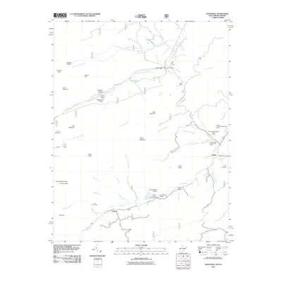
2011 Map of Waiteville
USGS Topo · Published 2011About this map
Waiteville serves as the primary settlement in this mountainous border region, where the Waiteville Post Office and nearby New Zion Cemetery mark the community's center. The landscape is defined by the parallel courses of North Fork Potts Creek and South Fork Potts Creek, which carve deep valleys between Potts Mountain and Brushy Mountain. This 2011 survey captures the local infrastructure of the area, including the industrial legacy found at Rays Siding and a series of water management structures like the Johns Creek Number One Dam. Further south, the settlement of Captain sits along Johns Creek, while the War Spur Shelter indicates the presence of recreational trails along the high ridges of Salt Pond Mountain. The map also details more isolated locales such as Maggie and the Taylor Cemetery near the eastern boundary.
Find a feature on this map
59 named features on this map. Tap any name to fly to it.
Don’t see what you’re looking for? This feature index may not catch every label — zoom into the map to look around manually.
Map Details
Editions of this 2011 Waiteville Map
This is the sole edition of this map. No revisions or reprints were ever made.
Other maps of this area

1887 · Hinton
USGS Topo · 1:125,000

1887 · Lewisburg
USGS Topo · 1:125,000

1890 · Dublin
USGS Topo · 1:125,000

1890 · Christiansburg
USGS Topo · 1:125,000

1891 · Lewisburg
USGS Topo · 1:125,000

1891 · Dublin
USGS Topo · 1:125,000

1892 · Hinton
USGS Topo · 1:125,000

1921 · Alderson
USGS Topo · 1:48,000

1921 · Ronceverte
USGS Topo · 1:48,000

1923 · Ronceverte
USGS Topo · 1:62,500