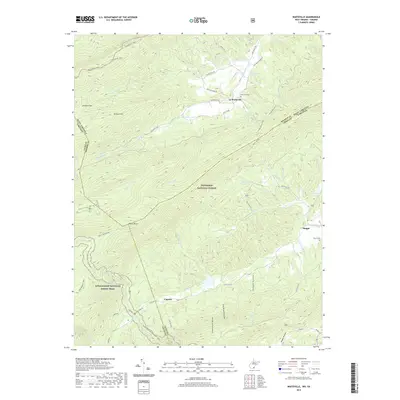
2019 Map of Waiteville
USGS Topo · Published 2019About this map
Waiteville serves as a focal point in this mountainous landscape where West Virginia and Virginia meet along the rugged spine of Potts Mountain. The settlement pattern follows the narrow valley floors, primarily along N Fork Potts Cr, while the surrounding slopes are heavily protected within the Jefferson National Forest. This 2019 survey documents a region defined by its topography and outdoor heritage, featuring the intersection of major trekking routes like the Appalachian National Scenic Trail and the Allegheny Trail. For local historians and genealogists, the map identifies small rural clusters such as Maggie and Captain, alongside significant family landmarks like New Zion Cem and Taylor Cem. The intricate drainage system, including Johns Cr and White Rock Br, highlights the watershed complexity that has historically dictated road placement and community isolation in this part of the Appalachian range.
Find a feature on this map
64 named features on this map. Tap any name to fly to it.
Don’t see what you’re looking for? This feature index may not catch every label — zoom into the map to look around manually.
Map Details
Editions of this 2019 Waiteville Map
This is the sole edition of this map. No revisions or reprints were ever made.
Other maps of this area

1887 · Hinton
USGS Topo · 1:125,000

1887 · Lewisburg
USGS Topo · 1:125,000

1890 · Dublin
USGS Topo · 1:125,000

1890 · Christiansburg
USGS Topo · 1:125,000

1891 · Lewisburg
USGS Topo · 1:125,000

1891 · Dublin
USGS Topo · 1:125,000

1892 · Hinton
USGS Topo · 1:125,000

1921 · Alderson
USGS Topo · 1:48,000

1921 · Ronceverte
USGS Topo · 1:48,000

1923 · Ronceverte
USGS Topo · 1:62,500