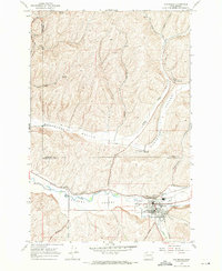
1967 Map of Waitsburg
USGS Topo · Published 1971About this map
Waitsburg serves as the focal point of this 1960s survey, situated where Coppei Creek and Wilson Creek meet the Touchet River. The landscape is defined by the agricultural industry of the Touchet Valley, evidenced by the prominent McKay Grain Elevators and additional facilities at Menoken and near the local Athletic Field. A sophisticated transportation network supports the region, with the Union Pacific and Northern Pacific railroads following the river and the northern Whetstone Hollow.
Find a feature on this map
30 named features on this map. Tap any name to fly to it.
Don’t see what you’re looking for? This feature index may not catch every label — zoom into the map to look around manually.
Map Details
Editions of this 1967 Waitsburg Map
This is the sole edition of this map. No revisions or reprints were ever made.
Other maps of this area

1919 · Walla Walla
USGS Topo · 1:125,000

1921 · Walla Walla
USGS Topo · 1:125,000

1953 · Walla Walla
USGS Topo · 1:250,000

1958 · Walla Walla
USGS Topo · 1:250,000

1966 · Dixie
USGS Topo · 1:24,000
1966 · Coppei
USGS Topo · 1:24,000

1966 · Valley Grove
USGS Topo · 1:24,000
1967 · Prescott
USGS Topo · 1:24,000

1967 · Waitsburg NW
USGS Topo · 1:24,000
1967 · Huntsville
USGS Topo · 1:24,000