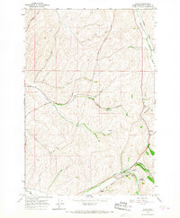
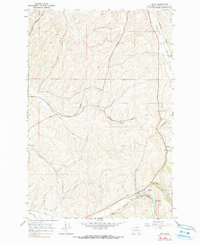
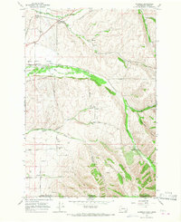
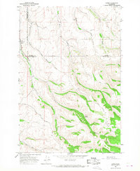
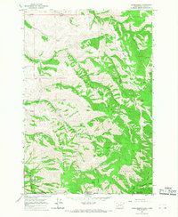
1966 Map of Dixie
USGS Topo · Published 1967About this map
Dixie and the surrounding agricultural landscape of Walla Walla County are defined by a network of grain infrastructure and early rail transport in the mid-1960s. The Northern Pacific railroad winds through the valley, connecting small shipping points and rail stops such as Bolles, Eastman, and Gilliam. This area, heavily invested in dryland wheat farming, features numerous Grain Elevators positioned strategically along the tracks to handle the harvest from the broad stretches of Spring Valley.
Find a feature on this map
19 named features on this map. Tap any name to fly to it.
Don’t see what you’re looking for? This feature index may not catch every label — zoom into the map to look around manually.
Map Details
Editions of this 1966 Dixie Map
2 editions found
Other maps of this area

1919 · Walla Walla
USGS Topo · 1:125,000

1921 · Walla Walla
USGS Topo · 1:125,000

1953 · Walla Walla
USGS Topo · 1:250,000

1958 · Walla Walla
USGS Topo · 1:250,000
1966 · Buroker
USGS Topo · 1:24,000
1966 · Coppei
USGS Topo · 1:24,000

1966 · Valley Grove
USGS Topo · 1:24,000
1966 · Kooskooskie
USGS Topo · 1:24,000
1966 · Walla Walla
USGS Topo · 1:24,000
1967 · Prescott
USGS Topo · 1:24,000