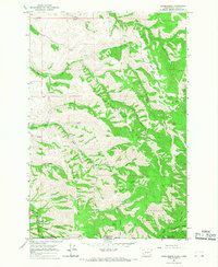
1966 Map of Kooskooskie
USGS Topo · Published 1968About this map
Kooskooskie sits at the southern edge of this mid-1960s study, where the Railroad and Mill Creek wind through the deep Mill Creek Canyon. The terrain is defined by dramatic parallel spurs including Blacksnake Ridge and Biscuit Ridge, separated by the steep drainages of Dry Creek and Blue Creek. These ridges served as natural corridors for travel, indicated by the Lewis Peak Road and the Blue Creek Trail traversing the heights. Evidence of local recreation and seasonal residency appears in labels for Kiwanis Camp and Stewart Cabin near the forest interior. The boundary of the Umatilla National Forest cuts across the southern portion of the sheet, marking the transition from the upland ridges down toward the canyon floor where an Intake, Dam, and Gaging Sta reflect the managed water resources of the Walla Walla watershed.
Find a feature on this map
43 named features on this map. Tap any name to fly to it.
Don’t see what you’re looking for? This feature index may not catch every label — zoom into the map to look around manually.
Map Details
Editions of this 1966 Kooskooskie Map
Other maps of this area

1919 · Walla Walla
USGS Topo · 1:125,000

1921 · Walla Walla
USGS Topo · 1:125,000

1937 · Pomeroy
USGS Topo · 1:96,000

1942 · Pomeroy
USGS Topo · 1:125,000

1953 · Pendleton
USGS Topo · 1:250,000

1953 · Walla Walla
USGS Topo · 1:250,000

1955 · Pullman
USGS Topo · 1:250,000

1955 · Grangeville
USGS Topo · 1:250,000

1956 · Pendleton
USGS Topo · 1:250,000

1958 · Pullman
USGS Topo · 1:250,000