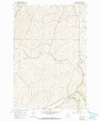
1966 Map of Dixie
USGS Topo · Published 1990About this map
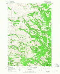
The Northern Pacific railroad tracks cut a definitive path through this landscape, serving the agricultural hubs of Dixie and Minnick. This area is characterized by its vital grain infrastructure, with Grain Elevators positioned strategically at Gilliam and Minnick to handle the harvests from the surrounding hills. The topography is defined by the winding courses of Coppei Creek and Dry Creek, alongside the seasonal Mud Creek. Roadways such as Spring Valley Road and Stonecipher Road weave through the terrain, connecting isolated Wells and small family-named landmarks. A lonely Cem and scattered Gravel Pits provide discrete markers of the community's local history and industry during the mid-1960s. The map illustrates a well-organized rural network where the railroad and local drainage patterns dictated the placement of every elevator and settlement.
Find a feature on this map
18 named features on this map. Tap any name to fly to it.
Don’t see what you’re looking for? This feature index may not catch every label — zoom into the map to look around manually.
Map Details
Editions of this 1966 Dixie Map
2 editions found
Other maps of this area

1919 · Walla Walla
USGS Topo · 1:125,000

1921 · Walla Walla
USGS Topo · 1:125,000

1953 · Walla Walla
USGS Topo · 1:250,000

1958 · Walla Walla
USGS Topo · 1:250,000
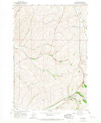
1966 · Dixie
USGS Topo · 1:24,000
1966 · Buroker
USGS Topo · 1:24,000
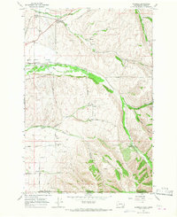
1966 · Coppei
USGS Topo · 1:24,000

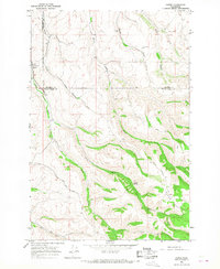
1966 · Valley Grove
USGS Topo · 1:24,000
1966 · Kooskooskie
USGS Topo · 1:24,000
1966 · Walla Walla
USGS Topo · 1:24,000