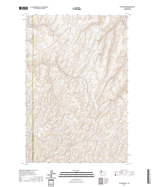
2023 Map of Waitsburg NW
USGS Topo · Published 2023About this map
Fields Gulch and the surrounding drainage basins define this portion of the Columbia and Walla Walla County border. This 2023 landscape is characterized by a dense network of seasonal drainages and hollows, including Colville Springs Hollow and Smith Springs Hollow, which carve through the high plateau. The map reveals a rural infrastructure built around these geographical features, with roads such as Graveyard Hill Rd and Kellogg Hollow Rd following the natural contours of the land. The presence of Colville Springs suggests the historical importance of reliable water sources in this dry upland environment. While the area remains primarily agricultural and sparsely settled, the detailed labeling of local routes like Manuel Hollow Rd and Grant Herriot Ln provides a precise record of contemporary property access and land use patterns.
Find a feature on this map
24 named features on this map. Tap any name to fly to it.
Don’t see what you’re looking for? This feature index may not catch every label — zoom into the map to look around manually.
Map Details
Editions of this 2023 Waitsburg NW Map
This is the sole edition of this map. No revisions or reprints were ever made.
Other maps of this area

1919 · Walla Walla
USGS Topo · 1:125,000

1921 · Walla Walla
USGS Topo · 1:125,000

1948 · Starbuck
USGS Topo · 1:62,500

1948 · Ayer
USGS Topo · 1:62,500

1950 · Starbuck
USGS Topo · 1:62,500

1950 · Haas
USGS Topo · 1:62,500

1953 · Walla Walla
USGS Topo · 1:250,000

1958 · Walla Walla
USGS Topo · 1:250,000
1967 · Prescott
USGS Topo · 1:24,000

1967 · Waitsburg NW
USGS Topo · 1:24,000