
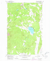
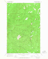
1965 Map of Waitts Lake
USGS Topo · Published 1967About this map
The resource-rich landscape of Stevens County, Washington, is captured here in the mid-1960s, defined by a distinct network of industrial extraction and mountain terrain. Industrial operations like the Finch Quarry and Colville Valley Mine anchor the local economy of the era, while numerous smaller sites such as the B & B Mine and Woodbury Quarry are scattered throughout the hills. This industrial presence is woven into a geography marked by significant elevation changes, from the heights of Wrights Mountain and Lane Mtn down to the agricultural flats of the Colville Valley.
Find a feature on this map
41 named features on this map. Tap any name to fly to it.
Don’t see what you’re looking for? This feature index may not catch every label — zoom into the map to look around manually.
Map Details
Editions of this 1965 Waitts Lake Map
2 editions found
Other maps of this area

1927 · Chewelah
USGS Topo · 1:125,000

1930 · Chewelah
USGS Topo · 1:125,000

1958 · Sandpoint
USGS Topo · 1:250,000

1963 · Sandpoint
USGS Topo · 1:250,000

1964 · Chewelah
USGS Topo · 1:24,000

1964 · Chewelah Mtn
USGS Topo · 1:62,500
1965 · Empey Mountain
USGS Topo · 1:24,000
1965 · Addy
USGS Topo · 1:24,000
1965 · Dunn Mountain
USGS Topo · 1:24,000
1965 · Stensgar Mtn.
USGS Topo · 1:24,000