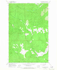
1965 Map of Empey Mountain
USGS Topo · Published 1967About this map
The Spokane Indian Reservation Boundary defines the southern portion of this landscape, marking a significant cultural and administrative border within the forested terrain of Stevens County. The topography is dominated by the massive ridge of Huckleberry Mountain to the west and Empey Mountain and Cooney Mountain to the east. This 1965 field-checked survey illustrates a region shaped by natural drainage and resource extraction, with numerous small-scale industrial sites such as a Mine, Prospect, and Gravel Pit scattered among the peaks.
Find a feature on this map
19 named features on this map. Tap any name to fly to it.
Don’t see what you’re looking for? This feature index may not catch every label — zoom into the map to look around manually.
Map Details
Editions of this 1965 Empey Mountain Map
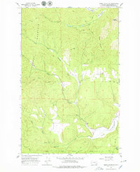
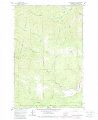
Other maps of this area

1927 · Chewelah
USGS Topo · 1:125,000

1930 · Chewelah
USGS Topo · 1:125,000

1944 · Wellpinit
USGS Topo · 1:62,500

1948 · Hunters
USGS Topo · 1:62,500

1948 · Turtle Lake
USGS Topo · 1:62,500

1950 · Turtle Lake
USGS Topo · 1:62,500

1950 · Hunters
USGS Topo · 1:62,500

1953 · Wellpinit
USGS Topo · 1:62,500

1953 · Ritzville
USGS Topo · 1:250,000

1954 · Okanogan
USGS Topo · 1:250,000