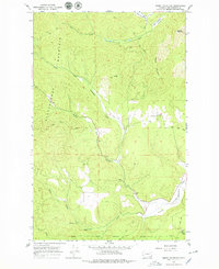
1965 Map of Empey Mountain
USGS Topo · Published 1979About this map
Camas Valley and the surrounding peaks of the Huckleberry Mountain range characterize this portion of Stevens County. The terrain is defined by the headwaters of Chamokane Creek, which draws from several branches including the Middle Fork and South Fork. These watercourses create a distinct drainage pattern through the high country, with significant elevations at Empey Mountain and Cooney Mountain.
Find a feature on this map
21 named features on this map. Tap any name to fly to it.
Don’t see what you’re looking for? This feature index may not catch every label — zoom into the map to look around manually.
Map Details
Editions of this 1965 Empey Mountain Map
Other maps of this area

1927 · Chewelah
USGS Topo · 1:125,000

1930 · Chewelah
USGS Topo · 1:125,000

1944 · Wellpinit
USGS Topo · 1:62,500

1948 · Hunters
USGS Topo · 1:62,500

1948 · Turtle Lake
USGS Topo · 1:62,500

1950 · Turtle Lake
USGS Topo · 1:62,500

1950 · Hunters
USGS Topo · 1:62,500

1953 · Wellpinit
USGS Topo · 1:62,500

1953 · Ritzville
USGS Topo · 1:250,000

1954 · Okanogan
USGS Topo · 1:250,000