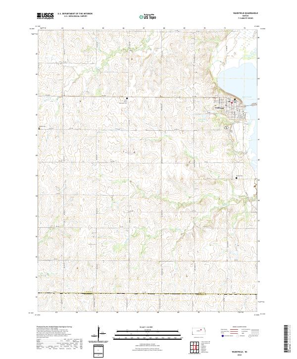
2022 Map of Wakefield
USGS Topo · Published 2022About this map
Wakefield sits at the northeastern edge of this prairie landscape, positioned where the residential grid meets the expanding waters of Milford Lake. The town's layout is defined by streets such as Knollwood St and Juniper St, serving as a focal point for the surrounding agricultural sections. The rural character of the region is preserved through several family and community burial grounds, including Highland Cem near the town center and the more isolated Mizpah Cem and Madura Cem. Water defines the eastern and central geography, from the larger reservoir to the smaller Clay County Lake and the meandering paths of Quimby Cr and Cane Cr. The southern border follows the Clay Co Dickinson Co line, illustrating the transition between these two Kansas counties through a network of section-line roads like Paint Road (1800) and Nail Road (1600).
Find a feature on this map
60 named features on this map. Tap any name to fly to it.
Don’t see what you’re looking for? This feature index may not catch every label — zoom into the map to look around manually.
Map Details
Editions of this 2022 Wakefield Map
This is the sole edition of this map. No revisions or reprints were ever made.
Other maps of this area

1886 · Junction City
USGS Topo · 1:125,000

1889 · Junction City
USGS Topo · 1:125,000

1891 · Clay Center
USGS Topo · 1:125,000

1894 · Junction City
USGS Topo · 1:125,000

1947 · Fort Riley
USGS Topo · 1:62,500

1950 · Alida
USGS Topo · 1:24,000

1951 · Milford
USGS Topo · 1:24,000

1955 · Milford
USGS Topo · 1:24,000
1955 · Alida
USGS Topo · 1:24,000

1955 · Manhattan
USGS Topo · 1:250,000