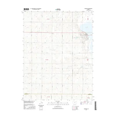
2015 Map of Wakefield
USGS Topo · Published 2015About this map
Wakefield serves as the primary hub in this eastern Clay County landscape, positioned along the western shores of Milford Lake. The town's grid is well-defined by streets such as Birch St and Elm St, with Highland Cem located at its northern edge. The surrounding terrain is a network of section-line roads and creek drainages, including Cane Cr and Quimby Cr, which carve through the agricultural fields of Township 9 South.
Find a feature on this map
50 named features on this map. Tap any name to fly to it.
Don’t see what you’re looking for? This feature index may not catch every label — zoom into the map to look around manually.
Map Details
Editions of this 2015 Wakefield Map
This is the sole edition of this map. No revisions or reprints were ever made.
Other maps of this area

1886 · Junction City
USGS Topo · 1:125,000

1889 · Junction City
USGS Topo · 1:125,000

1891 · Clay Center
USGS Topo · 1:125,000

1894 · Junction City
USGS Topo · 1:125,000

1947 · Fort Riley
USGS Topo · 1:62,500

1950 · Alida
USGS Topo · 1:24,000

1951 · Milford
USGS Topo · 1:24,000

1955 · Milford
USGS Topo · 1:24,000
1955 · Alida
USGS Topo · 1:24,000

1955 · Manhattan
USGS Topo · 1:250,000