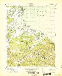
1943 Map of Wakefield
USGS Topo · Published 1943About this map
Wakefield National Park anchors this coastal Virginia landscape, centered on the birthplace of George Washington. The 1943 survey details a region where tidal creeks and swamps meet the broad Potomac River, defining the character of Westmoreland County before mid-century modernization. The map reveals a dense network of small rural settlements and family-named localities such as Monroe Hall, Oak Grove, and Latanes, interconnected by a landscape of timber and tobacco farms.
Find a feature on this map
96 named features on this map. Tap any name to fly to it.
Don’t see what you’re looking for? This feature index may not catch every label — zoom into the map to look around manually.
Map Details
Editions of this 1943 Wakefield Map
This is the sole edition of this map. No revisions or reprints were ever made.
Other maps of this area

1889 · Fredericksburg
USGS Topo · 1:125,000

1892 · Fredericksburg
USGS Topo · 1:125,000

1892 · Montross
USGS Topo · 1:62,500

1894 · Wicomico
USGS Topo · 1:62,500

1894 · Fredericksburg
USGS Topo · 1:125,000

1895 · Wicomico
USGS Topo · 1:62,500

1895 · Nomini
USGS Topo · 1:125,000

1895 · Montross
USGS Topo · 1:62,500

1898 · Nomini
USGS Topo · 1:125,000

1902 · Wicomico
USGS Topo · 1:62,500