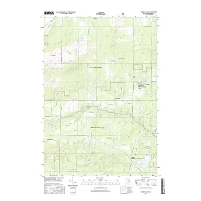
2017 Map of Wakeley Lake
USGS Topo · Published 2017About this map
MTC-H Camp Grayling dominates the northern landscape of this Crawford County region, where military training grounds meet protected forest lands. The Au Sable River cuts across the central portion of the map, serving as a primary drainage for the area's numerous glacial lakes and creeks. The settlement patterns reflect a mix of rural homesteads and seasonal retreats, centered around small hubs like Wildwood and Five Corners.
Find a feature on this map
87 named features on this map. Tap any name to fly to it.
Don’t see what you’re looking for? This feature index may not catch every label — zoom into the map to look around manually.
Map Details
Editions of this 2017 Wakeley Lake Map
This is the sole edition of this map. No revisions or reprints were ever made.
Other maps of this area

1949 · Lewiston
USGS Topo · 1:62,500

1949 · Otsego Lake
USGS Topo · 1:62,500

1949 · Grayling
USGS Topo · 1:62,500

1950 · Grayling
USGS Topo · 1:24,000

1950 · Lovells
USGS Topo · 1:24,000

1950 · Roscommon North
USGS Topo · 1:24,000

1951 · K P Lake
USGS Topo · 1:24,000

1951 · Big Bradford Lake
USGS Topo · 1:24,000

1951 · Lovells
USGS Topo · 1:24,000

1951 · Wakeley Lake
USGS Topo · 1:24,000