2022 Map of Wakulla
USGS Topo · Published 2022About this map
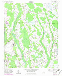
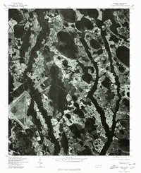
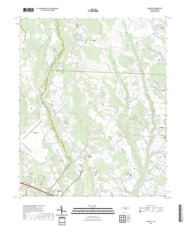
Floral College stands as a focal point in this southern Robeson County landscape, where the flat coastal plain is deeply carved by the meandering Lumber River. The river forms a natural boundary between Scotland and Robeson counties, its oxbows and floodplains contrasting with the straight agricultural grids and timber tracts that define the surrounding terrain. To the southeast, the small settlement of Wakulla sits near the headwaters of Gum Swamp, while Maxton occupies the southwestern corner near the expansive Laurinburg/Maxton Airport. Numerous family burial grounds, including McPhatter Cem, Lillys Chapel Cem, and McLean Cem, are scattered across the quadrangle, reflecting a long-established rural community structure. This modern survey illustrates how traditional land use patterns persist alongside large-scale infrastructure, with watercourses like Shoe Heel Cr and Jordan Swamp continuing to dictate the placement of roads and homesteads.
Find a feature on this map
106 named features on this map. Tap any name to fly to it.
Don’t see what you’re looking for? This feature index may not catch every label — zoom into the map to look around manually.
Map Details
Editions of this 2022 Wakulla Map
This is the sole edition of this map. No revisions or reprints were ever made.
Historical Maps of Maxton Through Time
7 maps found