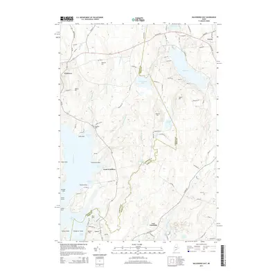
2014 Map of Waldoboro East
USGS Topo · Published 2014About this map
Coastal inlets and tidal reaches define the landscape of the Medomak River and Meduncook River basins at the border of Lincoln and Knox counties. The settlement at South Waldoboro and the small harbor area at Lawry highlight the region's enduring connection to the water. Topography is marked by numerous named summits, including Thomas Hill, Howard Hill, and Stahls Hill, which overlook a series of freshwater bodies such as Sidensparker Pond and South Pond. Inland, the Orff Cem near East Friendship provides a specific point of interest for family historians. The terrain transitions from these high points down to the complex shoreline of Sampson Cove, Dutch Neck, and Long Cove, where landmarks like Pitchers Point and Havener Ledge define the navigation of the Muscongus Bay approaches.
Find a feature on this map
92 named features on this map. Tap any name to fly to it.
Don’t see what you’re looking for? This feature index may not catch every label — zoom into the map to look around manually.
Map Details
Editions of this 2014 Waldoboro East Map
This is the sole edition of this map. No revisions or reprints were ever made.
Other maps of this area

1904 · Monhegan
USGS Topo · 1:62,500

1904 · Tenants Harbor
USGS Topo · 1:62,500

1904 · Rockland
USGS Topo · 1:62,500

1906 · Tennant Harbor
USGS Topo · 1:62,500

1906 · Monhegan
USGS Topo · 1:62,500

1906 · Rockland
USGS Topo · 1:62,500

1913 · Waldoboro
USGS Topo · 1:48,000

1915 · Waldoboro
USGS Topo · 1:62,500

1941 · Rockland
USGS Topo · 1:62,500

1941 · Waldoboro
USGS Topo · 1:62,500