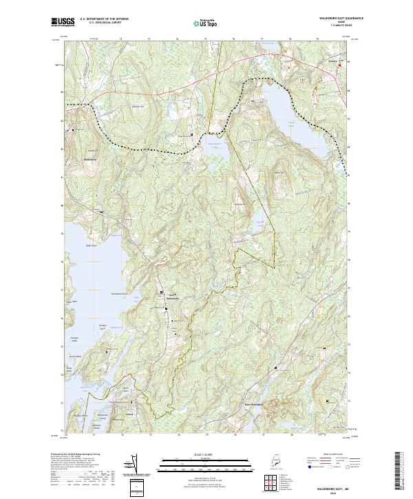
2024 Map of Waldoboro East
USGS Topo · Published 2024About this map
The coastal transition of the Goose River and Meduncook River basins defines this mid-coast landscape where the Lincoln Co and Knox Co lines meet. The settlement of Waldoboro sits at the head of navigation, with the surrounding countryside dotted by small, family-named burial grounds that speak to generations of local genealogy. These sites, including the Delano-Winchenbach Cem near Lawry and the Doe - Conant Cem to the east, are tucked between ridges like Demuth Hill and Stahls Hill.
Find a feature on this map
96 named features on this map. Tap any name to fly to it.
Don’t see what you’re looking for? This feature index may not catch every label — zoom into the map to look around manually.
Map Details
Editions of this 2024 Waldoboro East Map
This is the sole edition of this map. No revisions or reprints were ever made.
Other maps of this area

1904 · Monhegan
USGS Topo · 1:62,500

1904 · Tenants Harbor
USGS Topo · 1:62,500

1904 · Rockland
USGS Topo · 1:62,500

1906 · Tennant Harbor
USGS Topo · 1:62,500

1906 · Monhegan
USGS Topo · 1:62,500

1906 · Rockland
USGS Topo · 1:62,500

1913 · Waldoboro
USGS Topo · 1:48,000

1915 · Waldoboro
USGS Topo · 1:62,500

1941 · Rockland
USGS Topo · 1:62,500

1941 · Waldoboro
USGS Topo · 1:62,500