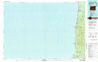
1980 Map of Waldport
USGS Topo · Published 1980About this map
Alsea Bay and the mouth of the Alsea River define the northern coastline of this 1980 region, where the town of Waldport serves as a primary coastal hub. The landscape is characterized by a series of dramatic headlands and points, including Yaquina John Point, Cape Perpetua, and Heceta Head, which is notably marked by the US Coast Guard Res Lighthouse. Moving inland, the dense terrain of the Siuslaw National Forest is segmented by numerous ridges such as Dicks Ridge and Blue Ridge, with peaks like Kerby Mtn and Fairview Mtn overlooking the drainage basins of Beaver Creek, Yachats River, and Big Creek.
Find a feature on this map
54 named features on this map. Tap any name to fly to it.
Don’t see what you’re looking for? This feature index may not catch every label — zoom into the map to look around manually.
Map Details
Editions of this 1980 Waldport Map
2 editions found
Other maps of this area

1918 · Mapleton
USGS Topo · 1:48,000

1919 · Earl
USGS Topo · 1:48,000

1920 · Siltcoos Lake
USGS Topo · 1:62,500

1920 · Heceta Head
USGS Topo · 1:62,500

1922 · Waldport
USGS Topo · 1:62,500

1940 · Mapleton
USGS Topo · 1:62,500

1941 · Siltcoos Lake
USGS Topo · 1:62,500

1942 · Waldport
USGS Topo · 1:62,500

1942 · Heceta Head
USGS Topo · 1:62,500

1942 · Yaquina
USGS Topo · 1:62,500