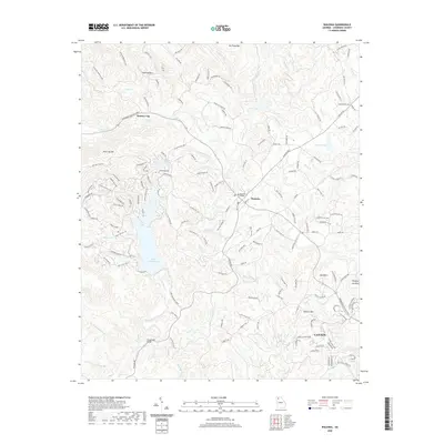
2020 Map of Waleska
USGS Topo · Published 2020About this map
Waleska and the northern edge of Canton anchor this 2020 map of northern Georgia, where the campus of Reinhardt College sits at the center of a landscape defined by significant water features and mountain peaks. The massive footprint of Lake Arrowhead dominates the western half of the terrain, surrounded by a dense network of residential loops such as Little Coyote Loop and Blue Fox Loop. Smaller bodies of water like Chickasaw Lake, Cline Lake, and Pittman Lake are scattered across the higher elevations between the summits of Garland Mtn and Polecat Mtn. The map preserves evidence of earlier transportation and infrastructure through labels like the Moores Mill Bridge and Beasley Gap, alongside modern thoroughfares like the Reinhardt College Pkwy. Numerous named creeks, including Shoal Cr and Lost Town Cr, drain the ridgelines toward the settled valleys of Cherokee County.
Find a feature on this map
160 named features on this map. Tap any name to fly to it.
Don’t see what you’re looking for? This feature index may not catch every label — zoom into the map to look around manually.
Map Details
Editions of this 2020 Waleska Map
This is the sole edition of this map. No revisions or reprints were ever made.
Other maps of this area

1890 · Suwanee
USGS Topo · 1:125,000

1890 · Cartersville
USGS Topo · 1:125,000

1891 · Cartersville
USGS Topo · 1:125,000

1894 · Suwanee
USGS Topo · 1:125,000

1896 · Cartersville
USGS Topo · 1:125,000

1907 · Acworth
USGS Topo · 1:62,500

1909 · Acworth
USGS Topo · 1:62,500

1926 · Tate
USGS Topo · 1:62,500

1928 · Tate
USGS Topo · 1:62,500

1947 · Waleska
USGS Topo · 1:62,500