
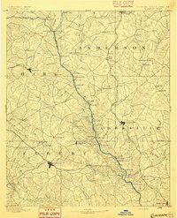
1886 Map of Walhalla
USGS Topo · Published 1886About this map
The Tugaloo River forms the central spine of this 1886 reconnaissance survey, marking the boundary between South Carolina and Georgia during a period of expanding rail infrastructure. In Oconee County, the town of Walhalla serves as a terminal for the Blue Ridge Railroad, while the landscape is dotted with early mountain outposts like Oconee Station and Batchelor's Retreat. The topography is dominated by the Tallulah Mountains and the dramatic drop of the Tallulah River at Tallulah Falls.
Find a feature on this map
129 named features on this map. Tap any name to fly to it.
Don’t see what you’re looking for? This feature index may not catch every label — zoom into the map to look around manually.
Map Details
Editions of this 1886 Walhalla Map
This is the sole edition of this map. No revisions or reprints were ever made.
Other maps of this area

1886 · Dahlonega
USGS Topo · 1:125,000

1888 · Pickens
USGS Topo · 1:125,000

1891 · Cowee
USGS Topo · 1:125,000

1891 · Gainesville
USGS Topo · 1:125,000

1891 · Carnesville
USGS Topo · 1:125,000

1892 · Dahlonega
USGS Topo · 1:125,000

1892 · Walhalla
USGS Topo · 1:125,000
1893 · Elberton
USGS Topo · 1:125,000

1894 · Pickens
USGS Topo · 1:125,000

1896 · Walhalla
USGS Topo · 1:125,000