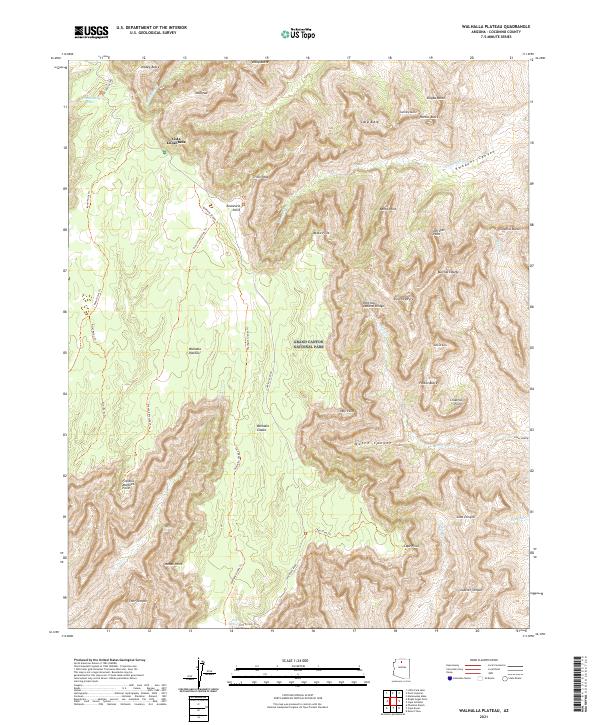
2021 Map of Walhalla Plateau
USGS Topo · Published 2021About this map
Vista Encantada and the high elevations of the Walhalla Plateau dominate this portion of Grand Canyon National Park. The landscape is a complex network of named prominences and drainage systems, where landmarks like Thor Temple, Juno Temple, and Jupiter Temple rise sharply from the surrounding canyons. A series of primitive trails, such as the Komo Point Trl and Ariel Point Trl, provide access to dramatic overlooks including Francois Matthes Point and Roosevelt Point.
Find a feature on this map
55 named features on this map. Tap any name to fly to it.
Don’t see what you’re looking for? This feature index may not catch every label — zoom into the map to look around manually.
Map Details
Editions of this 2021 Walhalla Plateau Map
This is the sole edition of this map. No revisions or reprints were ever made.
Other maps of this area

1886 · Echo Cliffs
USGS Topo · 1:250,000

1886 · Kaibab
USGS Topo · 1:250,000

1891 · Echo Cliffs
USGS Topo · 1:250,000

1903 · Bright Angel
USGS Topo · 1:48,000

1906 · Bright Angel
USGS Topo · 1:48,000

1907 · Vishnu
USGS Topo · 1:48,000

1953 · Grand Canyon
USGS Topo · 1:250,000

1954 · Nankoweap
USGS Topo · 1:62,500

1956 · Marble Canyon
USGS Topo · 1:250,000

1957 · Grand Canyon
USGS Topo · 1:250,000