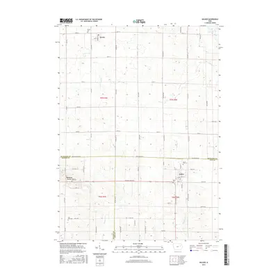
2015 Map of Walker
USGS Topo · Published 2015About this map
Walker and Rowley anchor this agricultural landscape at the tri-county junction of Buchanan, Benton, and Linn counties. The terrain is characterized by the steady drainage patterns of the region, specifically along the corridor of Blue Creek Rd. This 2015 survey illustrates a rural Iowa geography defined by its strict township and range grid, including t86n r8w and t87n r8w. Local history is preserved in landmarks such as the Sacred Heart Cem near the Linn-Buchanan border, reflecting the enduring community foundations of these small prairie settlements. The map highlights the intersection of modern road networks with traditional land divisions, providing a clear view of the area's rural development and agricultural infrastructure.
Find a feature on this map
11 named features on this map. Tap any name to fly to it.
Don’t see what you’re looking for? This feature index may not catch every label — zoom into the map to look around manually.
Map Details
Editions of this 2015 Walker Map
This is the sole edition of this map. No revisions or reprints were ever made.
Other maps of this area

1888 · Shellsburg
USGS Topo · 1:62,500

1888 · Marion
USGS Topo · 1:62,500

1889 · Marion
USGS Topo · 1:62,500

1889 · Shellsburg
USGS Topo · 1:62,500

1899 · Shellsburg
USGS Topo · 1:62,500

1903 · Winthrop
USGS Topo · 1:125,000

1959 · Dubuque
USGS Topo · 1:250,000

1961 · Dubuque
USGS Topo · 1:250,000

1962 · Dubuque
USGS Topo · 1:250,000
1968 · Lafayette
USGS Topo · 1:24,000