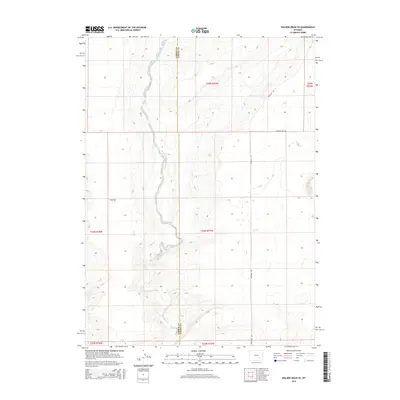
2015 Map of Walker Draw SE
USGS Topo · Published 2015About this map
Little Medicine Bow River meanders north-to-south through this high-plains landscape on the boundary of Carbon and Albany counties. The river corridor is the primary geographical feature, winding through a series of sections including T B Flat to the west. This 2015 survey illustrates a sparsely developed ranching or conservation environment where the natural drainage of the Little Medicine Bow dictates the topography. Transport is limited to a few arterial routes such as Marshall Rd and Starting Gate Rd, which provide access across the township lines of T24N and T25N. The map provides a clear record of property divisions and water rights in this remote part of Wyoming, where the elevation stays consistently above 6,700 feet.
Find a feature on this map
11 named features on this map. Tap any name to fly to it.
Don’t see what you’re looking for? This feature index may not catch every label — zoom into the map to look around manually.
Map Details
Editions of this 2015 Walker Draw SE Map
This is the sole edition of this map. No revisions or reprints were ever made.
Other maps of this area

1915 · Como Ridge
USGS Topo · 1:48,000

1918 · Como Ridge
USGS Topo · 1:62,500

1954 · Torrington
USGS Topo · 1:250,000

1954 · Cheyenne
USGS Topo · 1:250,000

1954 · Rawlins
USGS Topo · 1:250,000

1955 · Pine Tree Ridge
USGS Topo · 1:24,000

1955 · Casper
USGS Topo · 1:250,000

1958 · Rawlins
USGS Topo · 1:250,000

1958 · Casper
USGS Topo · 1:250,000

1958 · Cheyenne
USGS Topo · 1:250,000