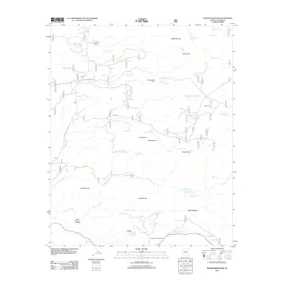
2011 Map of Walker Mountain
USGS Topo · Published 2011About this map
Walker Mountain and the surrounding high country of Yavapai County are defined by a network of ranching outposts and strategic water management. In the early 21st century, this landscape remains centered on livestock operations like the M Diamond Ranch in the north and Bull Pen Ranch near the center of the sheet. The terrain is marked by prominent landforms including Thirteenmile Rock Butte, Cedar Mountain, and Black Mountain, which overlook a series of basins such as Walker Basin and Blodgett Basin.
Find a feature on this map
102 named features on this map. Tap any name to fly to it.
Don’t see what you’re looking for? This feature index may not catch every label — zoom into the map to look around manually.
Map Details
Editions of this 2011 Walker Mountain Map
This is the sole edition of this map. No revisions or reprints were ever made.
Other maps of this area

1887 · Verde
USGS Topo · 1:250,000

1892 · Verde
USGS Topo · 1:250,000

1923 · Camp Verde
USGS Topo · 1:125,000

1929 · Turret Peak
USGS Topo · 1:125,000

1932 · Camp Verde
USGS Topo · 1:125,000

1933 · Turret Peak
USGS Topo · 1:125,000

1936 · Camp Verde
USGS Topo · 1:125,000

1954 · Holbrook
USGS Topo · 1:250,000

1957 · Holbrook
USGS Topo · 1:250,000

1958 · Holbrook
USGS Topo · 1:250,000