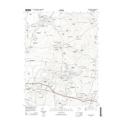
2014 Map of Walkersville
USGS Topo · Published 2014About this map
Walkersville and its surrounding residential developments sit at the heart of this Frederick County landscape, where modern suburban growth meets older rural foundations. The map illustrates a dense network of neighborhoods such as Colony Village, Glade Manor, and Discovery, which are woven between established landmarks like the historic Monocacy River and Israel Creek. A distinctive pattern of water-focused planning is evident along the southeastern corridor, where Lake Linganore and Lake Anita Louise are surrounded by communities like North Shore and Balmoral.
Find a feature on this map
232 named features on this map. Tap any name to fly to it.
Don’t see what you’re looking for? This feature index may not catch every label — zoom into the map to look around manually.
Map Details
Editions of this 2014 Walkersville Map
This is the sole edition of this map. No revisions or reprints were ever made.
Other maps of this area

1893 · Frederick
USGS Topo · 1:125,000

1894 · Frederick
USGS Topo · 1:125,000

1908 · Ijamsville
USGS Topo · 1:62,500

1909 · Mount Airy
USGS Topo · 1:62,500

1909 · Ijamsville
USGS Topo · 1:62,500

1911 · Taneytown
USGS Topo · 1:62,500

1911 · Emmitsburg
USGS Topo · 1:62,500

1942 · Frederick
USGS Topo · 1:62,500

1942 · Gettysburg
USGS Topo · 1:125,000

1943 · Emmitsburg
USGS Topo · 1:62,500