
1944 Map of Walkersville
USGS Topo · Published 1944About this map
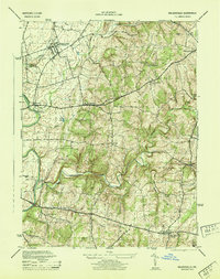
Walkersville and its surrounding rural hamlets are mapped here during the mid-1940s, revealing a landscape defined by traditional industry and water management in Frederick County. The Pennsylvania RR cuts through the northern reach of the territory, serving the agricultural and industrial needs of the era. Evidence of local extraction is visible near Ceresville at the Old Quarry and a nearby Lime Kiln, while the Fish Ponds on Addison Run suggest specialized land use.
Find a feature on this map
28 named features on this map. Tap any name to fly to it.
Don’t see what you’re looking for? This feature index may not catch every label — zoom into the map to look around manually.
Map Details
Editions of this 1944 Walkersville Map
2 editions found
Other maps of this area

1893 · Frederick
USGS Topo · 1:125,000

1894 · Frederick
USGS Topo · 1:125,000

1908 · Ijamsville
USGS Topo · 1:62,500

1909 · Mount Airy
USGS Topo · 1:62,500

1909 · Ijamsville
USGS Topo · 1:62,500

1911 · Taneytown
USGS Topo · 1:62,500

1911 · Emmitsburg
USGS Topo · 1:62,500

1942 · Frederick
USGS Topo · 1:62,500

1942 · Gettysburg
USGS Topo · 1:125,000

1943 · Emmitsburg
USGS Topo · 1:62,500