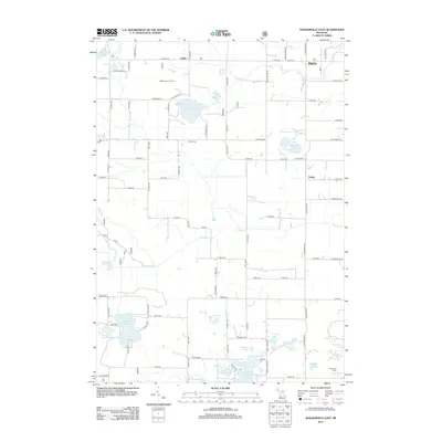
2012 Map of Walkerville East
USGS Topo · Published 2012About this map
Gilbert Lake Oil Field and the Huber Oil Field underscore the industrial character of this corner of Oceana County, where natural resource extraction coexists with a dense network of inland lakes and wetlands. The settlement of Colfax and the community of Troy are connected by a grid of rural routes like Jackson Rd and N 192nd Ave, while Spring Hill rises above the southern drainage of the N Br White River. Local genealogy is well-represented by several burial grounds, including Troy Cem and Abson Cem, which serve as quiet landmarks among the glacial kettle lakes such as Gilbert Lake, McLaren Lake, and Mountain Lake. The map reveals a landscape defined by small-scale agriculture and timbered tracts, punctuated by landmarks like the Po at the western edge and the crossroads at Volney.
Find a feature on this map
89 named features on this map. Tap any name to fly to it.
Don’t see what you’re looking for? This feature index may not catch every label — zoom into the map to look around manually.
Map Details
Editions of this 2012 Walkerville East Map
This is the sole edition of this map. No revisions or reprints were ever made.
Other maps of this area

1931 · Custer SW
USGS Topo · 1:31,680

1931 · Walkerville NE
USGS Topo · 1:31,680

1931 · Walkerville SW
USGS Topo · 1:31,680

1931 · Walkerville NW
USGS Topo · 1:31,680

1931 · Custer SE
USGS Topo · 1:31,680

1931 · Walkerville SE
USGS Topo · 1:31,680

1954 · Milwaukee
USGS Topo · 1:250,000

1954 · Midland
USGS Topo · 1:250,000

1958 · Midland
USGS Topo · 1:250,000

1958 · Milwaukee
USGS Topo · 1:250,000