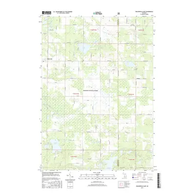
2017 Map of Walkerville East
USGS Topo · Published 2017About this map
The Manistee National Forest covers much of this landscape in eastern Oceana County, defined by a dense network of glacial lakes and small watercourses. The village of Walkerville sits on the western edge of the quadrangle, while the smaller settlement of Volney occupies the eastern reaches near the Oceana and Newaygo County line. The terrain is notably wet, characterized by expansive areas like Tanner Swamp and numerous named basins including Gilbert Lake, McLaren Lake, and Sorter Lake.
Find a feature on this map
65 named features on this map. Tap any name to fly to it.
Don’t see what you’re looking for? This feature index may not catch every label — zoom into the map to look around manually.
Map Details
Editions of this 2017 Walkerville East Map
This is the sole edition of this map. No revisions or reprints were ever made.
Other maps of this area

1931 · Custer SW
USGS Topo · 1:31,680

1931 · Walkerville NE
USGS Topo · 1:31,680

1931 · Walkerville SW
USGS Topo · 1:31,680

1931 · Walkerville NW
USGS Topo · 1:31,680

1931 · Custer SE
USGS Topo · 1:31,680

1931 · Walkerville SE
USGS Topo · 1:31,680

1954 · Milwaukee
USGS Topo · 1:250,000

1954 · Midland
USGS Topo · 1:250,000

1958 · Midland
USGS Topo · 1:250,000

1958 · Milwaukee
USGS Topo · 1:250,000