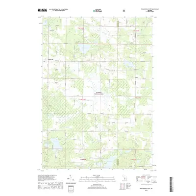
2019 Map of Walkerville East
USGS Topo · Published 2019About this map
Walkerville and the surrounding woodlands of the Manistee National Forest characterize this part of eastern Oceana County and western Newaygo County. The landscape is heavily defined by its glacial hydrology, featuring a dense network of lakes and marshes including Gilbert Lake, Campbell Lake, and the expansive Tanner Swamp. The southern portion of the sheet is drained by the N Br White River, while smaller settlements like Volney and Colfax anchor the rural road grid. Genealogists will find particular value in the documentation of several local burial sites, such as Abson Cem, Volney Cem, and Troy Cem, which are scattered among the timberlands and small agricultural clearings. The map reveals a transition between managed forest land and the established homesteads that mark the region’s history of settlement and recreation.
Find a feature on this map
80 named features on this map. Tap any name to fly to it.
Don’t see what you’re looking for? This feature index may not catch every label — zoom into the map to look around manually.
Map Details
Editions of this 2019 Walkerville East Map
This is the sole edition of this map. No revisions or reprints were ever made.
Other maps of this area

1931 · Custer SW
USGS Topo · 1:31,680

1931 · Walkerville NE
USGS Topo · 1:31,680

1931 · Walkerville SW
USGS Topo · 1:31,680

1931 · Walkerville NW
USGS Topo · 1:31,680

1931 · Custer SE
USGS Topo · 1:31,680

1931 · Walkerville SE
USGS Topo · 1:31,680

1954 · Milwaukee
USGS Topo · 1:250,000

1954 · Midland
USGS Topo · 1:250,000

1958 · Midland
USGS Topo · 1:250,000

1958 · Milwaukee
USGS Topo · 1:250,000