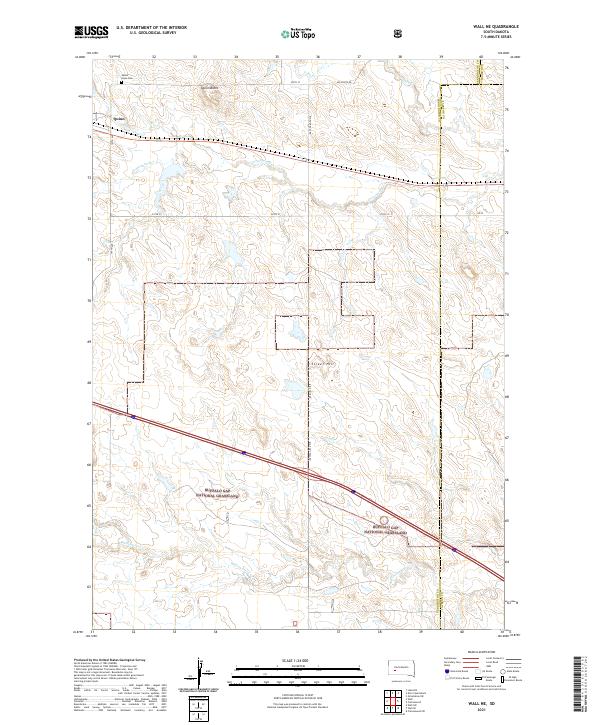
2021 Map of Wall NE
USGS Topo · Published 2021About this map
The settlement of Quinn sits in the northwest corner of this West River landscape, serving as a gateway to the vast stretches of the Buffalo Gap National Grassland that dominate the southern half of the quadrangle. In this portion of the South Dakota plains, the topography is defined by the drainages of Cottonwood Cr, Whitewater Cr, and Big Foot Cr, which carve through the high prairie. Local landmarks like Quinn Butte and Street Hill rise above the surrounding terrain, providing orientation in a region of sprawling sections and straight-line roads such as Big Foote Rd and 235th St. Genealogists may find interest in the Mount Hope Cem located just north of town. The map illustrates the 21st-century rural character of the area, where large-scale land management and natural watercourses define the layout of the country.
Find a feature on this map
22 named features on this map. Tap any name to fly to it.
Don’t see what you’re looking for? This feature index may not catch every label — zoom into the map to look around manually.
Map Details
Editions of this 2021 Wall NE Map
This is the sole edition of this map. No revisions or reprints were ever made.
Other maps of this area

1953 · Rapid City
USGS Topo · 1:250,000

1954 · Pierre
USGS Topo · 1:250,000

1955 · Hot Springs
USGS Topo · 1:250,000

1955 · Martin
USGS Topo · 1:250,000

1957 · Rapid City
USGS Topo · 1:250,000

1958 · Pierre
USGS Topo · 1:250,000

1958 · Martin
USGS Topo · 1:250,000

1960 · Wall SE
USGS Topo · 1:24,000

1960 · Wall
USGS Topo · 1:24,000

1960 · Cottonwood SW
USGS Topo · 1:24,000