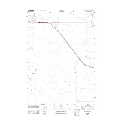
2012 Map of Wall
USGS Topo · Published 2012About this map
Wall Municipal Airport and the local grid of Main St and S Blvd define the northwestern corner of this Pennington County landscape as it appeared in 2012. The area is marked by a transition from the structured town layout to a network of rural routes like Creighton Rd and Quinn Rd, which intersect the path of Interstate 90. Further south, the terrain becomes more varied with the presence of Bloom Basin and the winding courses of Whitewater Cr and Bull Cr.
Find a feature on this map
18 named features on this map. Tap any name to fly to it.
Don’t see what you’re looking for? This feature index may not catch every label — zoom into the map to look around manually.
Map Details
Editions of this 2012 Wall Map
This is the sole edition of this map. No revisions or reprints were ever made.
Other maps of this area

1953 · Rapid City
USGS Topo · 1:250,000

1954 · Wasta SE
USGS Topo · 1:24,000

1955 · Hot Springs
USGS Topo · 1:250,000

1957 · Rapid City
USGS Topo · 1:250,000

1960 · Quinn Table NE
USGS Topo · 1:24,000

1960 · Wall SE
USGS Topo · 1:24,000

1960 · Wall
USGS Topo · 1:24,000

1960 · Quinn Table SE
USGS Topo · 1:24,000
1960 · Wall SW
USGS Topo · 1:24,000
1961 · Wall NE
USGS Topo · 1:24,000