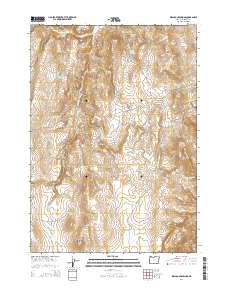
2014 Map of Wall Rock Springs
USGS Topo · Published 2014About this map
Wall Rock Ridge and Quartz Mtn dominate this high-desert landscape in Malheur County, where the scarcity of water has historically shaped land use. The map reveals an intricate network of water management features, including the Juniper Ranch Reservoir, S Wall Rock Reservoir, and the curiously named Sometime Reservoir. These catchment systems, alongside natural points like Wall Rock Springs and Black Bull Springs, supported livestock and transit across the arid terrain. The presence of West Page Cabin Spring hints at former habitation or seasonal camps in the vicinity of Knottingham Butte. Along the southern margin, the topography gives way to the Owyhee Breaks and the expansive Big Mud Flat, illustrating the transition from volcanic ridges to the eroded plateaus and seasonal basins characteristic of the region.
Find a feature on this map
29 named features on this map. Tap any name to fly to it.
Don’t see what you’re looking for? This feature index may not catch every label — zoom into the map to look around manually.
Map Details
Editions of this 2014 Wall Rock Springs Map
This is the sole edition of this map. No revisions or reprints were ever made.
Other maps of this area

1906 · Mitchell Butte
USGS Topo · 1:125,000

1955 · Boise
USGS Topo · 1:250,000

1958 · Boise
USGS Topo · 1:250,000

1962 · Boise
USGS Topo · 1:250,000

1967 · Diamond Butte
USGS Topo · 1:24,000

1967 · Twin Springs
USGS Topo · 1:24,000

1967 · Quartz Mtn Basin
USGS Topo · 1:24,000

1972 · Cedar Mountain
USGS Topo · 1:24,000

1972 · Big Mud Flat
USGS Topo · 1:24,000
1972 · Wall Rock Springs
USGS Topo · 1:24,000