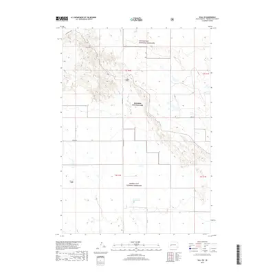
2017 Map of Wall SW
USGS Topo · Published 2017About this map
Badlands National Park and the expansive Buffalo Gap National Grassland dominate this Pennington County landscape, where the prairie suddenly gives way to the sharp topographic relief of the White River Badlands. Geological formations like the Pinnacles and Dillon Pass serve as landmarks within the complex terrain of the Conata Basin. The transport network here is sparse, defined by gravel tracks such as Sagecreek Rim Rd and Conata Basin Rd that trace the rim of the high plateau or descend into the eroded valleys below. Water management in this semi-arid environment is evidenced by features like the Conata East 302 Reservoir, which supports the region's ranching and conservation needs. Drainage patterns are established by Sage Cr in the northwest and Kimball Cr in the east, illustrating how seasonal water has sculpted the dramatic South Dakota badlands over millennia.
Find a feature on this map
16 named features on this map. Tap any name to fly to it.
Don’t see what you’re looking for? This feature index may not catch every label — zoom into the map to look around manually.
Map Details
Editions of this 2017 Wall SW Map
This is the sole edition of this map. No revisions or reprints were ever made.
Other maps of this area

1950 · Conata
USGS Topo · 1:24,000

1950 · Bouquet Table
USGS Topo · 1:24,000

1952 · Conata NE
USGS Topo · 1:24,000

1952 · Bouquet Table
USGS Topo · 1:24,000

1952 · Conata
USGS Topo · 1:24,000

1955 · Hot Springs
USGS Topo · 1:250,000

1960 · Quinn Table NE
USGS Topo · 1:24,000

1960 · Wall SE
USGS Topo · 1:24,000

1960 · Wall
USGS Topo · 1:24,000

1960 · Quinn Table SE
USGS Topo · 1:24,000