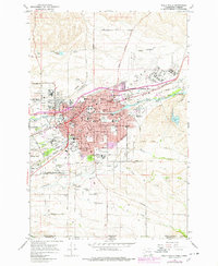
1966 Map of Walla Walla
USGS Topo · Published 1978About this map
Whitman College and the County Courthouse anchor the urban core of this 1960s study, which shows the city's growth toward Eastgate and College Place. The map captures a transition as the purple-shaded revisions of the late 1970s detail new residential expansion and development over earlier farmland. A significant institutional footprint is visible, ranging from the State Penitentiary in the north to the U S Veterans Hospital and the grounds of Fort Walla Walla Park to the west. Outside the city limits, the landscape is defined by the hydraulic patterns of Mill Creek, Yellowhawk Creek, and Garrison Creek, which support the region's agricultural productivity. These watercourses, along with infrastructure like the City County Airport and the Burlington Northern railroad lines, illustrate the city's role as a regional hub for education, medicine, and commerce.
Find a feature on this map
52 named features on this map. Tap any name to fly to it.
Don’t see what you’re looking for? This feature index may not catch every label — zoom into the map to look around manually.
Map Details
Editions of this 1966 Walla Walla Map
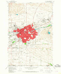
2 editions found
Other maps of this area

1919 · Walla Walla
USGS Topo · 1:125,000

1921 · Walla Walla
USGS Topo · 1:125,000

1953 · Pendleton
USGS Topo · 1:250,000

1953 · Walla Walla
USGS Topo · 1:250,000

1956 · Pendleton
USGS Topo · 1:250,000

1958 · Walla Walla
USGS Topo · 1:250,000

1963 · Peterson Ridge
USGS Topo · 1:24,000

1964 · Milton-Freewater
USGS Topo · 1:24,000

1964 · Bowlus Hill
USGS Topo · 1:24,000

1966 · Dixie
USGS Topo · 1:24,000