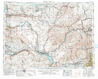
1953 Map of Walla Walla
USGS Topo · Published 1983About this map
The Columbia River and Snake River confluence anchors this regional overview, illustrating the mid-century development of the Tri-Cities and the expansive Hanford Reservation. This era reflects a landscape of intensive land management, from the military operations at Larson AFB and the Survival Training Area to the protected wetlands of the Columbia National Wildlife Refuge. The irrigation and hydroelectric potential of the basin is evident in the network of reservoirs like Potholes Reservoir and Lake Sacajawea, which reshaped the ancient drainage patterns of Crab Creek and Esquatzel Coulee.
Find a feature on this map
225 named features on this map. Tap any name to fly to it.
Don’t see what you’re looking for? This feature index may not catch every label — zoom into the map to look around manually.
Map Details
Editions of this 1953 Walla Walla Map
3 editions found

Other maps of this area

1906 · Blalock Island
USGS Topo · 1:125,000

1908 · Blalock Island
USGS Topo · 1:125,000

1908 · Umatilla
USGS Topo · 1:125,000

1909 · Quincy
USGS Topo · 1:62,500

1910 · Zillah
USGS Topo · 1:125,000

1910 · Quincy
USGS Topo · 1:62,500

1910 · Winchester
USGS Topo · 1:62,500

1911 · Red Rock
USGS Topo · 1:62,500

1912 · Moses Lake
USGS Topo · 1:62,500

1912 · Beverly
USGS Topo · 1:62,500