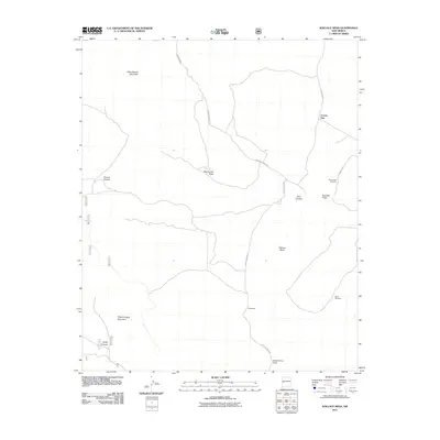
2011 Map of Wallace Mesa
USGS Topo · Published 2011About this map
Little Alegres Mountain and Wagontongue Mountain anchor this high-altitude landscape in western New Mexico. The area is defined by its drainage systems, with seasonal waterways like Dipping Vat Draw, Bear Canyon, and Saw Mill Draw cutting through the terrain. Human presence is sparse, centered on the settlement of Collinsville and the community site at Greens Gap, which includes the local Greens Gap Cemetery.
Find a feature on this map
23 named features on this map. Tap any name to fly to it.
Don’t see what you’re looking for? This feature index may not catch every label — zoom into the map to look around manually.
Map Details
Editions of this 2011 Wallace Mesa Map
This is the sole edition of this map. No revisions or reprints were ever made.
Other maps of this area

1918 · Pelona
USGS Topo · 1:125,000

1954 · Clifton
USGS Topo · 1:250,000

1954 · Saint Johns
USGS Topo · 1:250,000

1957 · Clifton
USGS Topo · 1:250,000

1957 · Saint Johns
USGS Topo · 1:250,000

1958 · Clifton
USGS Topo · 1:250,000

1958 · Saint Johns
USGS Topo · 1:250,000

1962 · Clifton
USGS Topo · 1:250,000

1962 · Saint Johns
USGS Topo · 1:250,000
1981 · Cox Peak
USGS Topo · 1:24,000